Software for the stripmap SAR data processing and calculation of deformation maps with sub-centimeter accuracy
 Funding: Italian Space Agency
Duration: 2010 – 2012
Country: Italy
Lead Partner: Geocart SpA
Partner: CGIAM
Budget: € 197.265,00
Objective:
The main project objectives were:
• To adapt the software tool “SLIDE[1]“” to the utilization of COSMO-SkyMed satellite data;
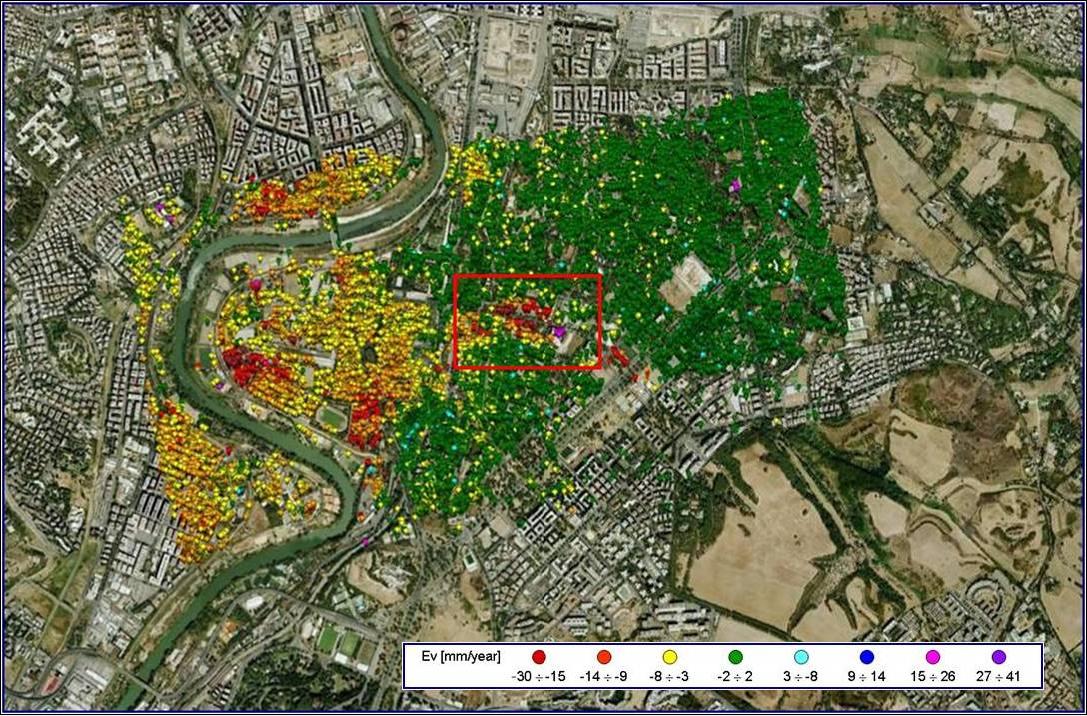
• To use some innovative tools, such as: the high resolution Digital Terrain Model acquired by airborne LiDAR systems, and a network of Passive Artificial Reflectors, specially designed and installed on the study sites. The use of Artificial Reflectors is generally aimed at increasing the target measurement in the study area and at assessing the location accuracy of the velocity measurements of the ground.
The project activities were characterized by an initial phase of development and testing of changes to be applied to the software tool “SLIDE” for the new SAR data utilization (COSMO-SkyMed – Constellation of small Satellites for the Mediterranean Basin Observation). In this phase some municipalities of the Basilicata Region (Maratea and Lagonegro), previously studied with historical ERS satellite data, were used as test sites. The second phase concerned the application of the new SLIDE on another site (Potenza). This application tested a network of Artificial Reflectors, installed on different types of ground (clay, rocky, sandy), orientation, slope, and on the roofs of industrial plants. The project development allowed, on the one hand, to widen the experience of algorithmic developing on SAR data processing, and on the other hand, to gain experience in modelling the Artificial Passive Reflectors and related installation practices. Moreover, the project experience highlighted the improvement of the displacement monitoring services through the use of COSMO-SkyMed (compared to the previously available ERS data). Specifically, it has been observed a significant increase in the number of measurement points, more accurate velocity measurements, the halving of the necessary images set.
[1] Software tool, developed by Geocart S.p.A, based on PSInSAR techniques (Permanent Scatterers for SAR Interferometry), able to detect slow constant movements.
Organismo scientifico di diritto pubblico per lo sviluppo socio-economico e lo studio dei rischi naturali, fondato sotto l’egida dell’UNESCO e della Regione Basilicata
Via Domenico Di Giura, 54 (Centro Direzionale), 85100 Potenza, Italy - Tel/Fax: +39 0971 69511 - CF: 80011410760