Our past
The Centre of Integrated Geomorphology for the Mediterranean Area (CGIAM) was established after a turn of events organized at the end of 60’s on initiative of scientific institutions of nation and international relevance, whose purpose was to foster a coordinated action in the scientific field for facing the problems connected to the regional development from an “integrated” viewpoint.
Some centres of integrated studies named “Centres of Integrated Geomorphology” were already established in other European Countries, and due to the importance of development plans, social and cultural heritage, the complexity of soil protection and Mediterranean coastal areas against pollutants, the Mediterranean Region is one of the area where this necessity was strongly perceived.
Hence the commitment of Italian scientific bodies and UNESCO to find a single concrete solution, namely a Coordinated Mediterranean Plan, considering the impossibility to solve the problems connected to the protection and development of the Mediterranean Regions without placing them in the wide Mediterranean context.
For this aim, after a conference in Calabria in 1967 organized by UNESCO, the Italian Ministry of Foreign Affairs and the Cassa per il Mezzogiorno, in October 1973 a meeting was held in Potenza arranged by the Italian Geological Service and the Institute of Botany of the University of Rome, under the aegis of UNESCO and Basilicata Region, attended by renowned experts and the then-best schools in the field of integrated geomorphology as follows:
- International Training Center of Delf, Enschede – The Netherlands,
- International Training Center of Sheffeld, Reading – UK,
- Centre of Coastal Geomorphology of Dinard – France.
During the meeting, it was recognized the need to establish a Central Coordinator Body able to face the problems linked to the protection and regional development of the whole Mediterranean Basin.
The success of the meeting not only sanctioned and codified the need to establish such a Mediterranean Centre, but also underlined the unanimous consensus of all the participants in recommending the Basilicata Region as its headquarter due to its geological, geomorphologic, landscape, environmental features as well as strategically located in the center of the Mediterranean Basin.
The advantages and the opportunity to establish the Centre of Integrated Geomorphology for the Mediterranean Area in Basilicata were particularly supported by the UNESCO Representative, the soviet Prof. Konstantino Lange, Head of Earth and Geomorphology Science, mainly with reference to the suggestion of some French delegates who proposed the candidature of Montpellier, France.
The choice of Basilicata and then Potenza was unanimously approved by drafting a resolution in which the participants wished for the organization of an international operations office in Basilicata, as above described.
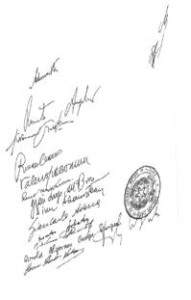
The signatories of the document were the representatives of scientific institutions of nation and international relevance such as:
- Prof. G.AVENA, Prof. F. BRUNO and Prof. V. GIACOMINI, Institute of Botany of the University of Rome;
- Dr. B. BECHETOILLE, Mediterranean Agronomic Institute of Bari;
- Dr. J. CALVET, Departamento Geomorfolgia y Tectonica di Barcellona;
- Dr. F. D’ANDREA and Dr. F. DRACO, Public Utility for the State Forests, Rome;
- Eng. G. L. DEL BONO, Prof. A. IACOBACCI, Dr. G.MARTELLI, Dr. L. PANNUZI, Prof. A. MORETTI, Italian Geological Service, Rome;
- Prof. DREET, Service de la carte de la Vegetation, Toulouse, France ;
- Prof. J. DUBOIS, Commissione Francaise pour l’UNESCO, Paris, France;
- Dr. H. ULLIOT and Prof. R. SAVIGEAR, Department of Geography, University, Reading;
- Dr. C. Ferri, Chief of the Regional Forest Inspectorate, Potenza, Italy;
- Dr. K. LANGE, Division of Ecology and Barth Sciences, UNESCO, Paris, France;
- Prof. F. MANCINI, Institute of Applied Geology, Florence, Italy;
- Dr. R. REGRAIN, Institut de Geographic, Universitè de Picardie, Amiens. France ;
- Prof. S. SADARIS, Facultad de Ciencias Universidad, Barcellona;
- Prof. F. VERGER, Ecole Pratique des Nautes Etudes, Paris, France;
- Prof. H. Th. VERSTAPPEN, Int. Inst. of Aerial Survey and Earth, Enoschede, The Netherlands.
This idea was successively shared also by the Italian Ministry of Foreign Affairs that, in November 1975, supported the establishment and the operation of the Centre of Integrated Geomorphology for the Mediterranean Area.
In November 1977, through the D.G.R. n. 305 of 25.11.1977, the Basilicata Region made official the launch of the constituent phase of the Centre, unanimously subscribed by its Regional Council.
 In February 1979, the Centre of Integrated Geomorphology for the Mediterranean Area was legally established with the agreement of the Basilicata Region, represented by the then-President On. Vincenzo VERRASTRO, by UNESCO and many personalities of the international academic community such as Prof. Dinu ADAMESTEANU, Prof. H. Th. VERSTAPPEN and Prof. Ronald SAVIGEAR, the Founding Members of Centre with Prof. G. AVENA, Prof. V. GIACOMINI, Prof. Eng. G. L. DEL BONO, Prof. G. PALMENTOLA, Prof. R. ANGELONI, Prof. R. MAZZARONE, Prof. R. CARRANO, Dr. G. MESSINA and Eng. D. SABATO.
CGIAM has been established for an indefinite duration, as non-profit organization, aimed at fostering the socio-economic development of the Mediterranean Region, through the integrated geomorphologic study of the areas of interest in order to reduce the natural and man-made risks, by using advanced technologies and guaranteeing an efficient protection of people and environment.
After the 1980 Irpinia earthquake that hardly hit the Campania and Basilicata Regions and thanks to Eng. Leggeri, Member of the Technical Scientific Committee of the Centre, CGIAM has started dealing with earthquake studies.
He should be given the credit for the design and achievement of the first seismometric network of Basilicata.
Organismo scientifico di diritto pubblico per lo sviluppo socio-economico e lo studio dei rischi naturali, fondato sotto l’egida dell’UNESCO e della Regione Basilicata
Via Domenico Di Giura, 54 (Centro Direzionale), 85100 Potenza, Italy - Tel/Fax: +39 0971 69511 - CF: 80011410760